
Short Answer
Overview
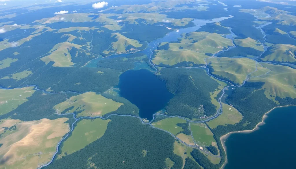
A watershed area, also known simply as a watershed, drainage basin, or catchment area, is a geographical region in which all surface water converges to a single point, typically a river, lake, reservoir, or the ocean. This natural landform determines how precipitation—such as rain or snow—flows across the terrain, collects, and eventually drains through a specific outlet. Watersheds vary widely in size, ranging from a few square kilometers draining into a small creek to vast regions covering thousands of square kilometers feeding major river systems.
Detailed Explanation
Watershed areas are defined by topographical features such as hills, ridges, and mountains that act as divides separating one watershed from another. The boundary lines, known as drainage divides or watershed divides, direct the flow of water downhill within each catchment. All tributaries, streams, and rivers within a watershed ultimately feed into a common waterbody, forming an interconnected hydrological network.
Watersheds play a critical role in the hydrological cycle by collecting precipitation that infiltrates the soil, recharges groundwater, or runs off the surface. They influence water quality, sediment transport, and ecosystem health downstream. Human activities such as urban development, agriculture, and deforestation within watershed areas can significantly impact water quantity and quality.
How It Works
When precipitation falls within a watershed, it follows gravity-driven pathways across the land. Some water is absorbed into the ground (infiltration), some collects in surface depressions, and the rest flows overland as runoff. The natural topography directs this runoff to converge into streams and rivers, moving toward the watershed’s outlet.
The size and shape of a watershed affect the timing and volume of water flow. For example, steep slopes and impermeable surfaces can lead to rapid runoff and potential flooding, while flat, vegetated areas promote infiltration and slower water movement. Watershed management often involves maintaining natural vegetation, controlling pollution sources, and designing infrastructure to mitigate flooding and erosion.
Examples
- Mississippi River Watershed (USA): One of the largest watersheds in the world, covering about 3.2 million square kilometers, draining into the Gulf of Mexico.
- Amazon Basin: The largest tropical watershed on Earth, feeding the Amazon River and encompassing parts of multiple South American countries.
- Thames River Watershed (UK): Covers much of southern England, draining into the North Sea, and is critical for London’s water supply.
- Smaller Local Watersheds: Many communities are situated within small watersheds that feed local streams and lakes, important for regional water management.
Why It Matters
Understanding watershed areas is essential for environmental planning, water resource management, and conservation efforts. Watersheds provide the spatial framework for assessing impacts of pollution, land use changes, and climate variability on water systems. Protecting watershed health ensures clean drinking water, supports biodiversity, helps prevent floods and droughts, and sustains agriculture and industry.
Common Misconceptions
Misconception: A watershed is just a river or a body of water.
Correction: A watershed is the entire land area that drains into a river or water body, not just the water body itself.
Misconception: Watersheds are always large geographic areas.
Correction: Watersheds can be very small, encompassing areas as limited as a few square meters, or extremely large, spanning millions of square kilometers.
Pros and Cons
Pros:
- Provides a natural framework for managing water resources.
- Helps in understanding and controlling pollution sources.
- Supports ecosystem health through integrated water flow management.
- Facilitates flood control and sustainable land use planning.
Cons:
- Watershed boundaries can be complex and difficult to delineate precisely.
- Human alterations can disrupt natural watershed functions, leading to environmental degradation.
- Managing watersheds often requires coordination across multiple jurisdictions and stakeholders.
Comparison Table
| Aspect | Watershed Area | River Basin |
|---|---|---|
| Meaning | The land area draining all precipitation to a common outlet. | Often used interchangeably with watershed, but sometimes refers specifically to larger drainage areas of major rivers. |
| Scale | Can be small or large, any scale where water converges. | Typically refers to larger drainage systems. |
| Focus | Includes all land and water flow paths within the boundary. | Focus on the river and its tributaries within the drainage. |
Decision Checklist
What is the easiest way to understand Watershed Area?
The simplest way to understand a watershed area is to imagine it as a large bowl-shaped piece of land where all rainwater falling inside the bowl eventually flows out through a single spout or outlet. This outlet could be a stream, river, lake, or ocean, and the edges of the bowl represent the watershed boundaries.
FAQ
What is the main difference between a watershed and a river basin?
The terms watershed and river basin are often used interchangeably, but a watershed generally refers to any land area draining to a single point, regardless of size, while a river basin usually denotes a larger drainage area of a major river system.
How do human activities affect watersheds?
Human activities such as urbanization, agriculture, and deforestation can alter natural water flow, increase pollution, reduce infiltration, and cause erosion within a watershed, impacting water quality and ecosystem health downstream.
Can a watershed have more than one outlet?
By definition, a watershed drains to a single outlet. However, in some complex terrain, water may split and drain into multiple outlets, in which case the area would be divided into separate watersheds based on flow paths.
Leave a Reply